Google Maps Mobile, the underestimated Google Buzz client

Having released Google Buzz a few days ago and seen the iPhone and Android interfaces which took the GMail-centric UI and simply ported it across to mobile, I was looking for similar integration with my Nokia E71 (S60) device.

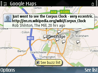
I very quickly realised that there wasn’t a new version of the GMail application, but there was a new version of Google Maps. This new version of Google Maps has integration with Google Buzz in the form of a Layer. Once turned on, this layer puts speech bubbles anywhere Buzz has been made. Add to this the fact that Buzz can be associated with places and businesses, this gives an excellent way to provide tips for people to find when they’re travelling.

I have to wonder, with Jyri Engeström having worked on features within Google Buzz, whether this is trying to, in any way build on the concept of the original Jaiku service (not the newer JaikuEngine-based service), where multiple feeds are taken into a single activity stream with location attached. One of my personal main use-cases of Jaiku was for travelling, so I could find people in the area to go for a drink with, and I have been lucky enough to get to know several people from around Finland because of it.
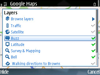
Enable the Buzz layer
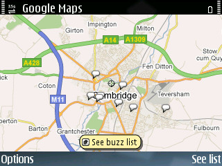
Buzz around Cambridge
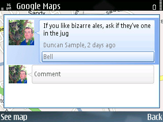
A location-specific Buzz

I’ve put some screenshots of how I used it on a night in the pub on Saturday.
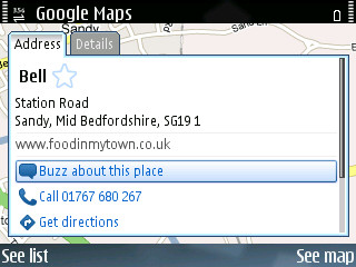
A pub on Google Maps
Buzz about the pub

Google Latitude Applications

I don’t know how I missed it, but within Google Latitude there are now options for sharing your location with others. Just go to the Google Latitude Applications page and enable the options that suit you. There’s an option to allow your IM contacts to see your location within GTalk (Jabber), and there are also options to get alerts from friends when you’re close, but away from your ‘usual locations’.

One of the more interesting features is the Public Location Badge. Although a possible privacy nightmare, having access to your location in KML and JSON format means that developers can start to utilise location without having develop individual mobile clients that use the GPS. Personally I would like to see the WordPress GeoRSS plugin use it to suggest my location when writing these posts.

I think there’s an additional corner which could be cut if we really opened up, by using the location information stored within the mobile operator’s network to give a rough location, without even having to run an application on the phone at all. This might sound closer to a 1984 scenario than anything before it, but the possibilities of knitting services tightly around the location of it’s users would be an incredibly valuable prospect.

The iPhone as a GPS/SatNav

You may have seen the latest Steve Jobs WWDC Keynote and iPhone adverts and be wondering about how good it will perform as a GPS device (as you would any modern mobile phone) or for Location Based Services (LBS).

A lot of people are looking forward to the release of the iPhone, and I guess only time will tell as to how it performs, but I can see some things which may backfire with the fully online (or at least that’s what it seems) platform.

  • Steve hasn’t mentioned anything about GPS support within the iPhone, but I don’t see it not having support.
  • Unless there are some sophisticated caching mechanisms, maps are going to be unavailable in areas of low mobile network coverage.
  • Points of Interest appear built into the phone are most probably the normal Google Maps, and possibly not very customisable.
  • Other POIs are capable through the web browser, with AJAX these websites can appear as if they are native applications on the phone, but only through clicking on an address/location of some sort to trigger the Google Maps view of that point.

I hope to be proven wrong, but those are my reservations. If I am proven correct, this would surely be a major issue for anyone (like myself) who uses GPS/GIS in anger. Any ideas?